 |
| Behrmann: 8,763 miles |
 |
| Bonne: 6,731 miles |
 |
| Equidistant Conic: 6,972 |
 |
| Equidistant Cylindrical: 5,061 |
 |
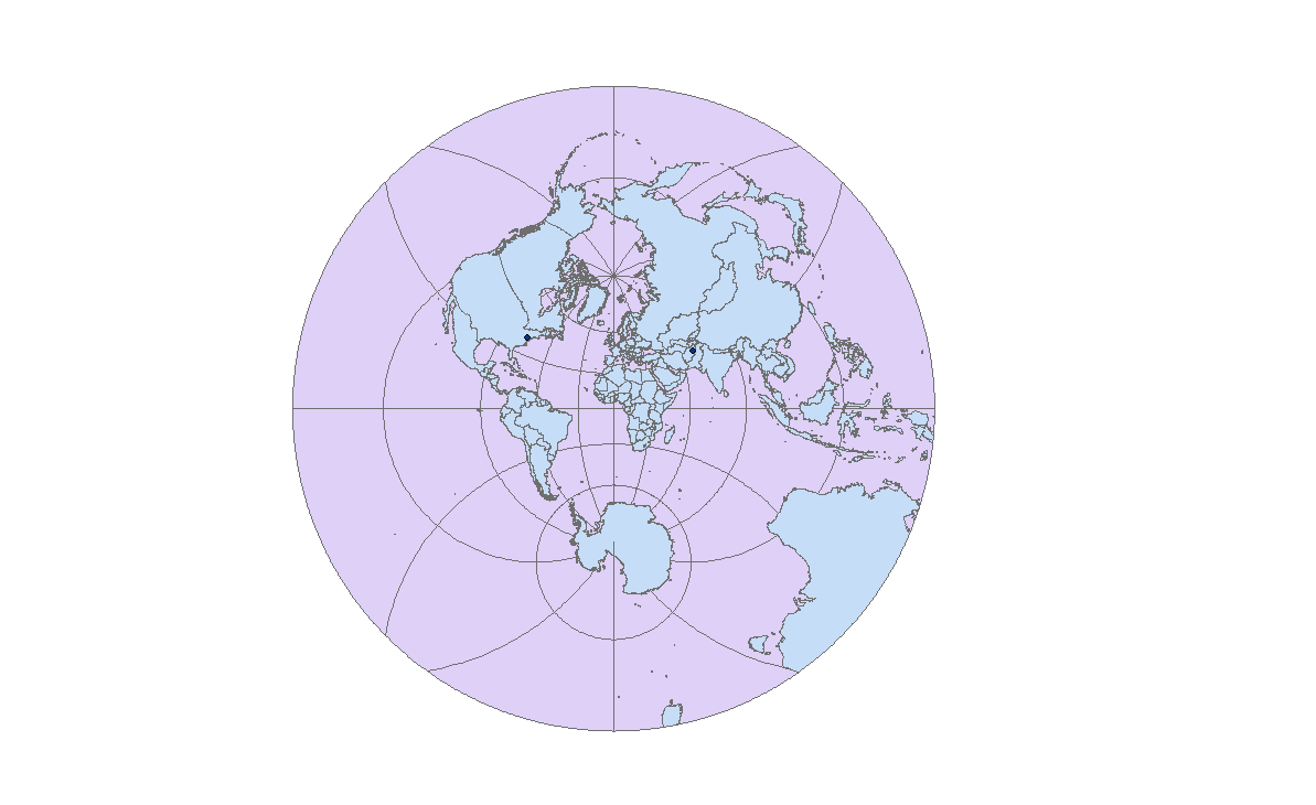
| Hotine: 9,629 |
 |
| Stereographic: 9947 |
Map projections are important for every single map projection distorts distances in some ways. It is important for people to understand that it is impossible to accurately flatten out a 3D area such as the earth. Therefore, there will be distortions depending on the type of map projection one chooses to use. There are no limitations to map projections and people may choose to use whichever they like. This may be important to determine average distances and for creating scales on maps. The quality of no limitation on the number of possible map projections is also useful for comparisons and contrasts. As seen above, I was able to choose whichever map projection I wanted to compare distances from Washington DC to Kabul, Afghanistan, all of which are different.
That is why it may be quite difficult for one to know the exact distance to a certain place. Depending on the map, this distance may differ. For instance, the six maps above all have different mile projections from Washington, D.C. to Kabul, Afghanistan. While the most accepted map projection form was the Lambert Conformal, people who do not understand map projections may look at any map and accept the distances to be true. This may be a pitfall of map projections for novices who have no prior understanding of the distortion concept. However, the Equidistant Conic and Bonne seem to have the closest distance projections in comparison to the others.
Further, map projections may be useful for they somewhat maintain the spherical shape of the earth. Maps would also not exist without map projections. A map is a flat representation of the Earth's surface, which is difficult to determine. With map projections, one can as accurately as possible create a flap map. Maps are more convenient and easier to carry than globes. Scales on maps also help people determine distances. In the examples above, each map projection maintains the spherical shape or either distorts land masses to fit accordingly to the scale. This maintains accuracy and allows end users to compare and contrast various distorted projections.
However, another pitfall of map projections is that one needs to be technically savvy. They need to understand how to use ARC GIS and the differences of each maps and the reasons for those differences. Thus, one really needs to have a solid understanding of map projections, differences and technology. It was a bit difficult at first for me to get used to the program, and it still is. If it wasn't for step by step directions, this lab may have taken me a lot longer to complete. Further, one needs to be educated about map distortions and projections. Although each projection may be pretty in picture, one needs to fully understand what each projection is doing, how it is doing what it is and why.
No comments:
Post a Comment